Water Resources

With nearly four decades of specialized experience, OEI is a leader in preserving, restoring, and maintaining our water resources. Founded with a mission to solve complex water challenges, we remain steadfast in protecting and enhancing surface water systems through innovative, data-driven design. Our expertise spans hydraulic, hydrologic, and hydrodynamic modeling, supporting projects of every scale and geography nationwide.
 

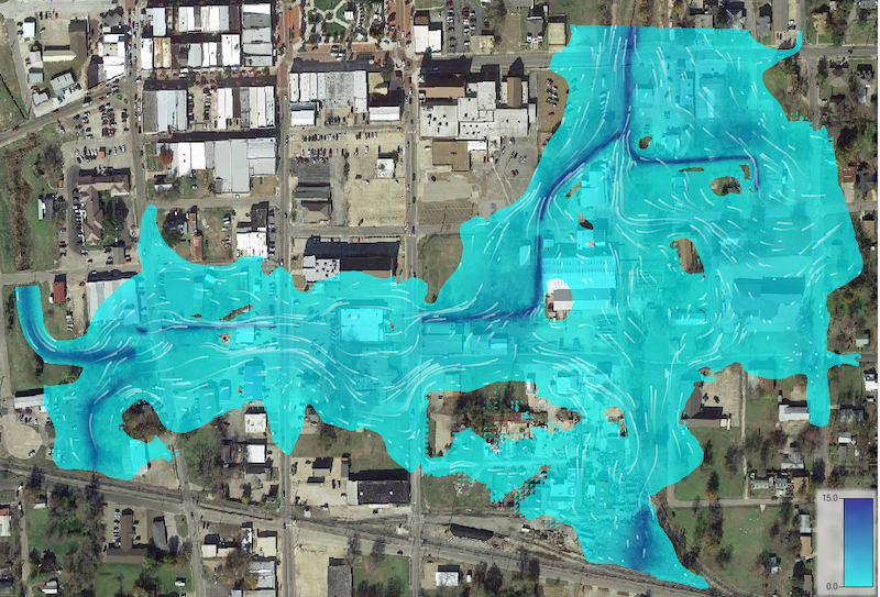
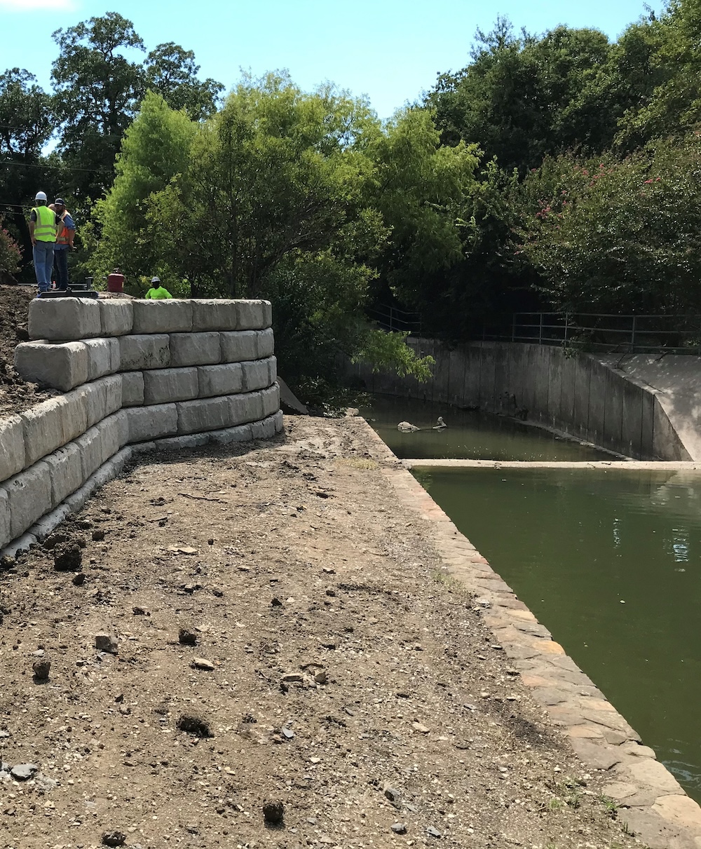
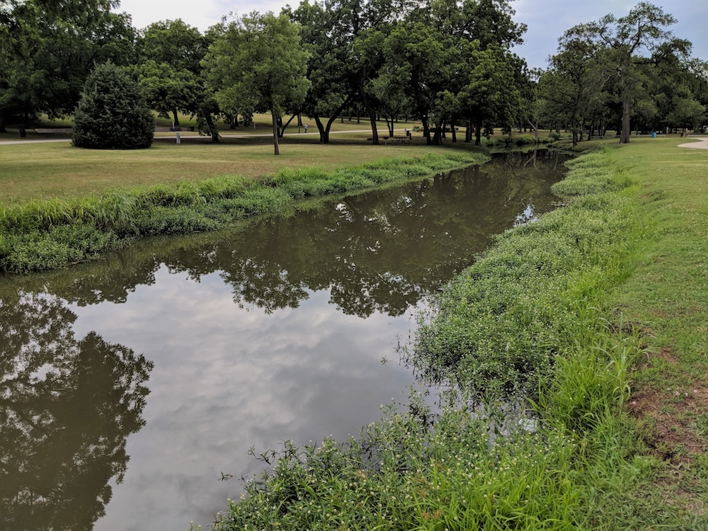
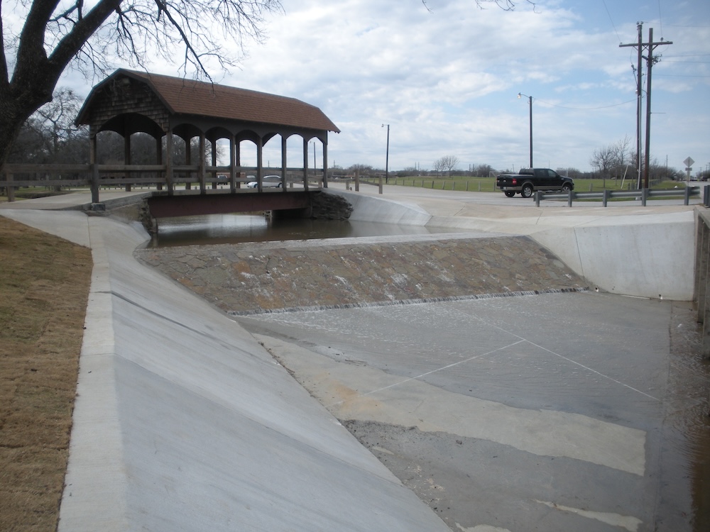
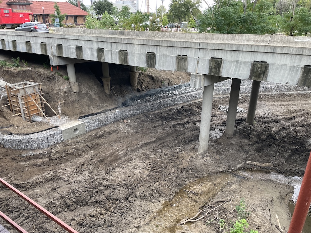
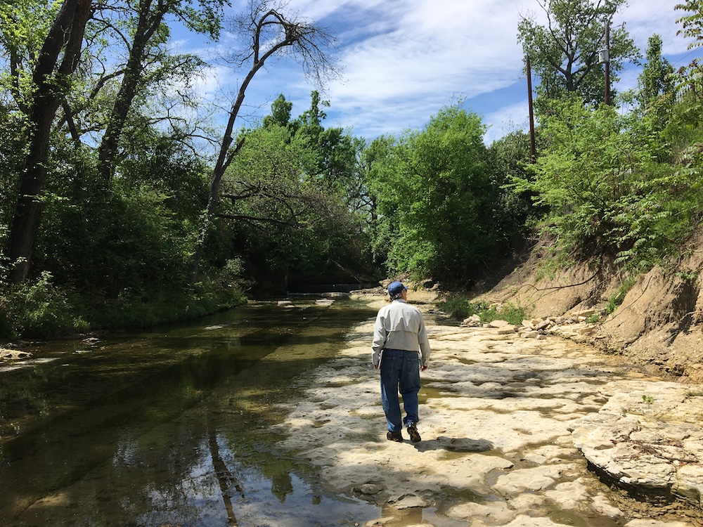
From floodplain mapping and stormwater master planning to dam safety evaluations, rehabilitations, and watershed restoration, OEI applies advanced modeling and field-based assessments to create resilient, sustainable solutions. We support both public and private clients with designs that integrate regulatory compliance, climate adaptation strategies, and long-term infrastructure performance.

Our services include:

  • Floodplain and drainage analysis

  • Erosion control and streambank stabilization

  • Dam and levee safety, rehabilitation, and monitoring

  • Culvert systems and detention basin optimization

  • Watershed and surface water restoration

  • Environmental studies and permitting

  • Construction phase services for complex water projects

Water resources engineering for Highland Park by OEI

Regulatory & Permitting Expertise

Decades of experience in the specialized world of water resource management and permitting have made OEI a trusted guide through the regulatory landscape. We understand that requirements from federal, state, and local agencies often overlap—or even conflict—on the same project site. These complexities can cause costly delays, redesigns, or approval setbacks.


OEI anticipates these challenges early and provides strategic permitting coordination, stakeholder engagement, and documentation aligned with evolving expectations. Our team has built efficiencies in streamlining approvals and established strong relationships with regulatory agencies, allowing us to navigate the process with greater speed and confidence.

Innovation in Practice

Beyond routine design, OEI has developed creative, economical solutions for unique challenges, while efficiently managing routine issues with expertise and precision. Our project managers bring deep knowledge of multi-agency impacts, site complexities, and water quality—sharing this expertise in a spirit of collaboration to deliver outstanding results today and into the future.


One of OEI’s most notable innovations is a state-wide water grid system, patented to address aging infrastructure, flooding, droughts, and aquifer recharge through a synergistic solution. Learn more at www.onewatersolved.com.

Featured Water Resources Projects

Farmers Branch Creek Bank Stabilization – Farmers Branch, TX

Citywide Streambank Stabilization Erosion Study – Keller, TX

Waxahachie Creek Erosion Control – Waxahachie, TX

Saturn Springs Estates Drainage Study & Neighborhood Improvements – Garland, TX

Base Level Engineering Evaluations (NM)

Over 1000 LOMCs SUBMITTED. And APPROVED.

A Track Record of Success

Few firms, let alone small businesses, can say they have submitted more than 1,000 requests for Letter of Map Change (LOMC – Letter of Map Revision, Letter of Map Amendment) to FEMA. Not only have we prepared this stunning number, our success rate speaks for itself: OEI has never been denied, nor have our requests on behalf of our clients ever been substantively modified.

OEI provided engineering services to stabilize stream banks along Farmers Branch Creek, where erosion had exposed municipal sanitary sewer infrastructure at three locations.
  • Proposed gabion basket walls with rock tie-backs to protect exposed utilities
  • Delivered geotechnical investigation, topographic surveying, wall layout, and structural design
  • Prepared technical specifications and provided construction-phase assistance
  • Strategically limited wall length to under 550 feet to maintain FEMA Nationwide Water Permit eligibility
OEI was selected by the City of Keller to conduct a comprehensive streambank erosion study across three major drainage channels: Big Bear Creek, Little Bear Creek, and Marshall Branch.
  • Performed field evaluations to assess erosion concerns and define stream geomorphology
  • Conducted topographic surveys to supplement gaps in existing hydraulic studies
  • Developed hydrologic and hydraulic models to analyze flow rates, velocities, and shear stresses
  • Identified areas of active or potential bank erosion along all three creeks
  • Delivered a study report with priority-ranked recommendations for streambank stabilization
  • Provided technical data to support future FEMA floodplain map revision
OEI was selected to design erosion control measures along Waxahachie Creek to protect newly developed public infrastructure in downtown Waxahachie.
  • Provided surveying, geotechnical investigation, and structural/civil design services
  • Designed a gabion basket wall with bedrock tie-backs to stabilize the creek bank near a new amphitheater
  • Incorporated three storm sewer extensions through the wall to maintain drainage functionality
  • Strategically limited wall length to under 550 feet to avoid Section 404 permitting requirements
  • Delivered a complete design package now pending construction bidding


**Recipient of the 2024 TX-APWA Project of the Year – Environmental, Small Cities/Rural Communities category**

OEI was engaged by the City of Garland to address erosion and flooding concerns in the Saturn Springs neighborhood as part of a bond-funded infrastructure initiative.
  • Conducted a drainage study of Ruppert Branch from Duck Creek to upstream of Saturn Road
  • Performed hydraulic modeling to assess bank erosion and flooding risks near residential properties
  • Evaluated two small dams within the reach and proposed mitigation alternatives
  • Analyzed storm drainage systems in adjacent neighborhoods to identify local deficiencies
  • Selected to design comprehensive neighborhood drainage improvements and full roadway rehabilitation
  • Relocated and replaced sanitary sewer infrastructure from alleyways to beneath the roadway
  • Facilitated multiple community meetings to address resident concerns and support collaborative design
BLE provides watershed-wide flood hazard data using modern modeling tools and high-resolution elevation data. To define terrain and floodplain boundaries, OEI provides Hydrologic & Hydraulic Modeling; Flood Risk Mapping; Estimated Base Flood Elevations (EBFEs); Inundation & Hazard Visualization support; and Support for FEMA Risk MAP & Local Planning.