Managing flood risk is an essential part of responsible community planning. Local governments and property owners rely on accurate, up-to-date flood data to guide decisions that safeguard lives, infrastructure, and economic stability. One of the most valuable tools for understanding and managing flood risk is a FEMA floodplain map.
Table of Contents
Floodplains typically form alongside streams, rivers, lakes, and coastal areas. When heavy rainfall or storm surge exceeds a waterway’s capacity, excess water spills into the floodplain, often impacting homes, businesses, and critical infrastructure.
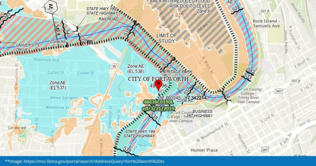
A FEMA floodplain map shows areas with a higher risk of flooding. These maps illustrate the shape, elevation, and extent of floodplains, giving communities a clear picture of how floodwater may behave during significant storm events.
Floodplain maps help answer essential questions, such as:
- Is this property located in a high-risk flood zone?
- What types of development are appropriate in this area?
- How much flood insurance is required?
- What infrastructure improvements or mitigation efforts are needed?
Insurance needs a FEMA floodplain map
Flooding can occur anywhere, but risk levels vary. FEMA categorizes areas into flood zones that help property owners understand the likelihood of flooding, which drives insurance requirements and costs.
- Higher risk zones generally require higher premiums.
- Mortgaged properties in high-risk zones typically require flood insurance.
- Property owners can make better decisions when they know their flood risk.
- Public officials can identify vulnerable areas and plan mitigation projects accordingly.
Stormwater patterns, urban development, and a changing climate make continuous flood risk evaluation critical. For individuals and communities, proactively using and updating their FEMA floodplain map helps reduce damage and improve long-term safety.
How FEMA and communities work together
FEMA does not create floodplain maps alone. These maps are built through collaboration among FEMA, state agencies, local governments, and engineering firms. Each contributes technical data and analyses.
Another way various organizations work together is that if communities maintain flood maps, they may qualify for the National Flood Insurance Program (NFIP). Participation also enables communities to access federal mitigation grants and post-disaster recovery support.
Why flood zone designations change
Flood zones are not static. Development, environmental changes, and updated hydraulic modeling can increase or reduce flood risk over time.
Common causes of changing flood designations include:
- New construction or land development that alters water flow
- Erosion or sedimentation affecting waterways
- Changes in watershed characteristics
- Improved data
When these factors shift, existing maps may become outdated. Communities must update their FEMA maps to reflect current risk conditions accurately.
Understanding the FEMA floodplain map LOMC process
A Letter of Map Change (LOMC) is the formal request submitted to FEMA to revise or amend an existing floodplain map. LOMCs can:
- Remove a structure or property from a special flood hazard area
- Update elevations
- Revise flood zone boundaries
- Reflect updated data
These requests must be backed by technical, professionally certified engineering analysis, which is why communities rely on specialized water resources engineering firms.
OEI’s proven record of successful map amendments
OEI has submitted over 1,000 LOMC requests on behalf of municipalities, developers, and property owners, and none have ever been denied. Our long-standing working relationship with FEMA, combined with our deep hydrologic and hydraulic expertise, ensures accurate data, compliant modeling, and thorough documentation to support map changes.
OEI supports communities by providing:
- Floodplain analysis and modeling
- Preparation and submission of LOMC requests
- Flood mitigation, resilience planning, and stormwater management consultation and planning
- Coordination with FEMA, other government agencies, and local jurisdictions
If your community has experienced recent growth, stormwater changes, or new development, it may be time to evaluate whether your existing maps reflect real-world conditions.
Take the next step toward a safer community
An accurate FEMA floodplain map helps reduce risk, support responsible development, and protect your community’s long-term economic and environmental health. If you believe your FEMA map is outdated or want expert guidance on managing flood risk, OEI is ready to help.
Start a conversation today to start the collaborative process of updating and improving your community’s flood resilience.